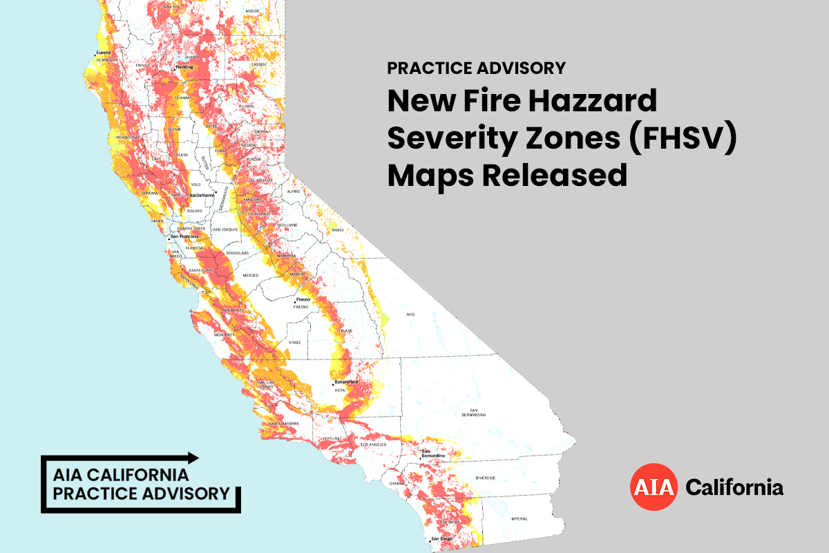
Practice Advisory //byline AIA California Staff (March 31, 2025) California’s Department of Forestry and Fire Protection, Cal Fire, has released the fourth and final round of new Fire Hazzard Severity Zones (FHSV) maps. These color coded maps show the potential level of risk for an area within the state and as a result, “roughly 1-in-10 Californians are now subject to an array of building code, defensible space and real estate disclosure rules, all of which could have lasting effects on how people live, communities plan and housing markets function in the state’s most flammable neighborhoods” according to CalMatters. What is a “Fire Hazard Severity Zone,” or FHSZ? According to the Public Resource Code 4202; The State Fire Marshal shall classify lands within state responsibility areas into fire hazard severity zones. Each zone shall embrace relatively homogeneous lands and shall be based on fuel loading, slope, fire weather, and other relevant factors present, including areas where winds have been identified by the department as a major cause of wildfire spread. Government Code 51178; The State Fire Marshal shall identify areas in the state as moderate, high, and very high fire hazard severity zones based on consistent statewide criteria and based on the severity of fire hazard that is expected to prevail in those areas. Moderate, high, and very high fire hazard severity zones shall be based on fuel loading, slope, fire weather, and other relevant factors including areas where winds have been identified by the Office of the State Fire Marshal as a major cause of wildfire spread. Why are fire hazard severity maps being updated? The maps are being updated to more accurately reflect the zones in California that are susceptible to wildfire. The hazard mapping process will incorporate new science in local climate data and improved fire assessment modeling in determining hazard ratings. The FHSZ maps are created using computational models that evaluates factors influencing fire risk and behavior to determine a hazard score. These factors include fire history, existing and potential fuel sources (such as natural vegetation), projected flame length, airborne embers, terrain, and typical fire weather conditions for the region. In State Responsibility Areas, hazard levels are classified into three categories: moderate, high, and very high. Important to note – these new maps are based upon current climatic conditions; as climates changes continue, the zones may expand in area and may increase in severity level. In addition, the maps’ boundaries are for legal purposes in the present not for predictive design models in the future. At this time Cal-Adapt is a resource to help predict these changes: Cal-Adapt What resources are available to determine the FHSZ of an area? CalFire has created a several educational resources and a tool to search a specific address for its FHSZ here: https://osfm.fire.ca.gov/what-we-do/community-wildfire-preparedness-and-mitigation/fire-hazard-severity-zones In addition, the California Department of Insurance also released frequently asked questions information regarding the impact of modifications to the FHSZ maps on the insurance landscape. What are the requirements for landowners in FHSZs in local responsibility areas? California’s WUI building codes (CBC Chapter 7A) apply to the design and construction of new buildings located in High and Very High FHSZs in Local Responsibility Areas. Local ordinances may require ignition resistant construction for remodel projects. Check with your local building department to determine which ignition resistant building codes apply to your project. In addition, Government Code Section 51182 calls for defensible space clearance and other wildland fire safety practices for buildings. Owners are also required to make a natural hazard disclosure as part of a real estate transfer. For information regarding “home hardening” and defensible space clearance, visit www.ReadyForWildfire.org. For more information about the new FHSZ, the process used to develop these maps, and the integration with the Wildfire Urban Interface code click here.
AIA CaliforniaRead More

